Geodesic project
Introduction:
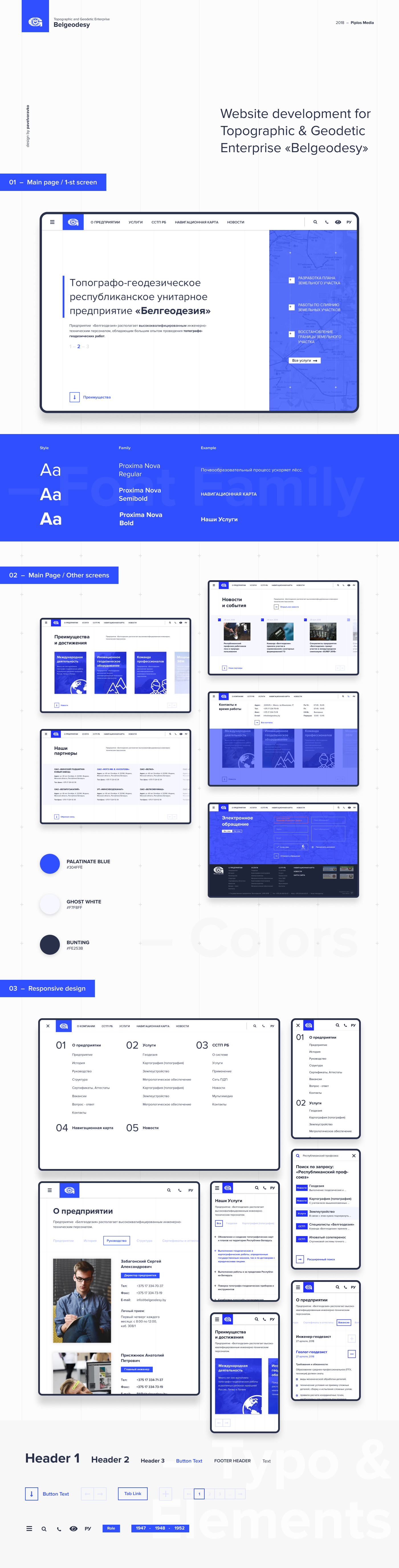
Geodesy is an important field that involves the measurement and representation of the earth's surface. Geodetic enterprises often face difficulties in managing their vast amounts of data. In order to solve this problem, our team of designers decided to develop a minimalist design for the project. This was achieved by removing unnecessary content elements from the website's homepage. Additionally, we developed extended capabilities for the text editor to work with different sections of the website. To enhance the functionality of the project, we integrated geodetic services, including an interactive map and the SSTP RB map.
Design:
The minimalist design approach was chosen to improve the user experience and help the user navigate the site with ease. This was achieved by simplifying the website's interface and eliminating unnecessary elements. We used a clean, white background and a simple color scheme that allows the user to focus on the content. The use of high-quality images and icons also helped to create an aesthetically pleasing design.
Functionality:
To improve the functionality of the website, we developed a text editor with extended capabilities. This allows for easy editing and management of the website's text sections. The editor also has an option to add multimedia elements, such as images and videos, to enhance the website's visual appeal.
Integration of Geodetic Services:
We integrated two geodetic services to enhance the functionality of the project: an interactive map and the SSTP RB map. The interactive map allows the user to view geodetic information in real-time, including topographic features and terrain elevation. The SSTP RB map displays the location of geodetic benchmarks and control points in the Republic of Belarus.
Conclusion:
In conclusion, the development of a minimalist design and the integration of geodetic services have greatly improved the functionality and user experience of the project. The extended capabilities of the text editor have also made it easier to manage the website's content. With these improvements, geodetic enterprises can better manage their data and present it in a user-friendly and aesthetically pleasing manner.